

Results 1 to 9 of 9
Thread: Keg Spring and Wolverton Canyons
-
03-10-2019, 11:23 PM #1
Keg Spring and Wolverton Canyons
In mid-November 2018, my friend Chris and I headed into the San Rafael Desert for a couple days of camping and hiking in Keg Spring Canyon and Wolverton Canyon. Our goal was to hike as many old trails as we could. We ended up hiking four different trails and locating a fifth for future exploration. We met at my house on Friday the 16th, loaded the Jeep, and headed south. We arrived at camp near the west fork of Keg Spring Canyon after dark, started a campfire, and drank some beer before dinner. It wasn't too chilly at night. We awoke when the sun rose on Saturday morning and the temperature was already quite comfortable.
Starry night at camp
Waking up to a warm, sunny morning
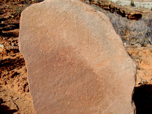
After breakfast we started hiking right from camp. This was Chris' first long hike since breaking his leg earlier in the year and he did quite well, never complaining despite some scrambling and a lot of ups-and-downs. We walked the rim of the west fork, finding many grinding slicks, petroglyphs, and inscriptions close to camp. One of the inscriptions was by Mont Caldwell, and I'd found many other inscriptions by him in my travels. There were also a lot of moki steps in the area, most of which appeared to serve no purpose. We dropped into a small canyon near camp and viewed some more petroglyphs before returning to the canyon rim and heading downstream.
Grinding slicks and sharpening grooves
Incised glyphs
Curvilinear petroglyphs
Human and sheep figures
Moki step
Good ol' Mont Caldwell
Entering a small slot canyon to check out some rock art
Unusual style of petroglyphs
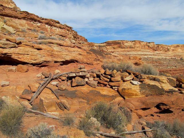
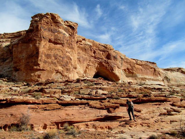
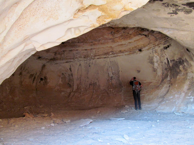
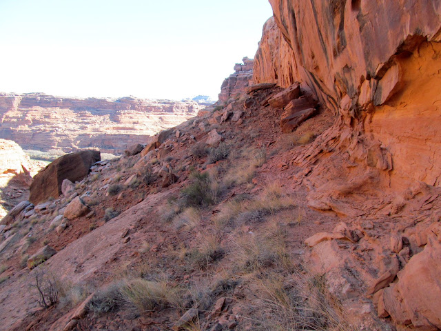
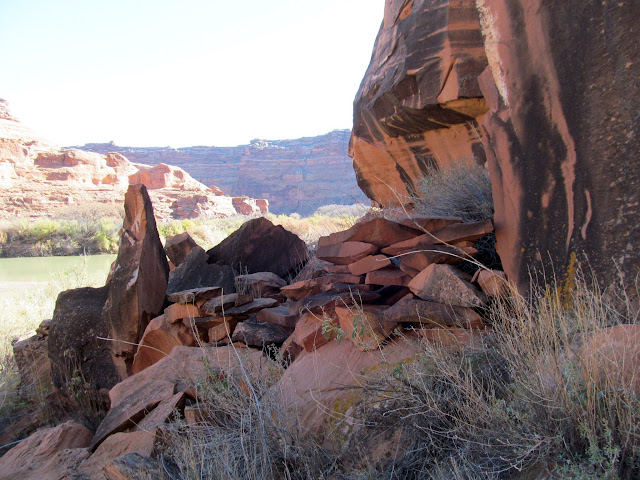
We dropped back down below the rim to check out a promising cliff covered in patina but didn't find anything there. Across the canyon, however, were a couple of 1934 inscriptions by Harold Twitchell, whose name I found scratched in lower Moonshine Wash five years earlier. We found our way to the top of the Andy Moore Trail, which I only roughly knew the location of but ended up being easy to find. Some of the sandstone cliffs above the trail had been drilled and blasted, presumably to create enough material to fill in the ledges below. Using that trail we entered the bottom of Keg Spring Canyon and then headed upstream into the middle fork of Keg Spring Canyon. There we found several rock walls designed to contain livestock, as well as a curious stone marker that simply said, "R.I.P. Solitude." We thought (and hoped) it was a memorial to a horse. Chris and I also quickly visited a cave in the middle fork that I'd been to before.
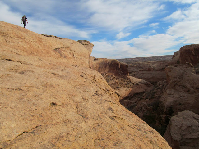
Walking the rim along the west fork of Keg Spring Canyon
H.H. Twitchell 1934
Heading toward that patinated cliff in the center
Climbing down below the rim
West fork of Keg Spring Canyon
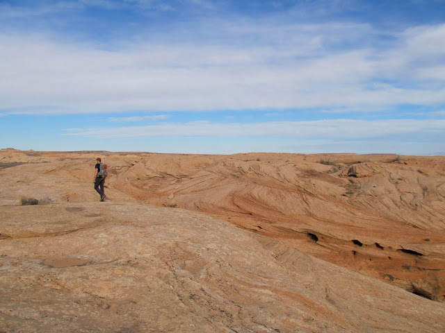
Slickrock walking
Top of the Andy Moore Trail
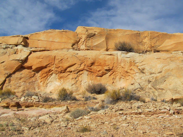
Drilled and blasted cliffs
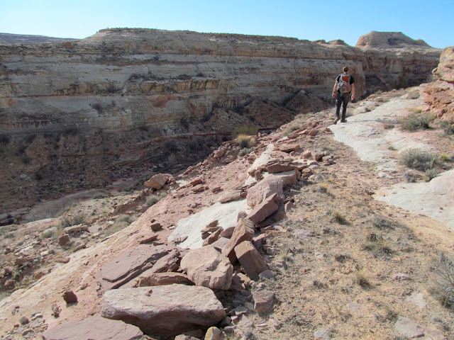
Andy Moore Trail
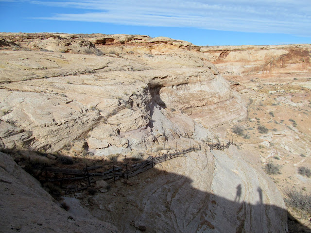
Stone fence
R.I.P. Solitude
Stone marker
Approaching the cave
Chris in the cave
Albert Weber, Feb. 18, 1928
Inside the cave looking out
Broken grinding stone
-
Post Thanks / Like - 5 Likes
-
03-10-2019 11:23 PM # ADS
-
03-10-2019, 11:23 PM #2
Next we briefly entered the east fork of Keg Spring Canyon to try locating the Wolverton Trail. We located the trail easily and followed it to the canyon rim. I'd read that this trail was used to carry minerals from a mine near Keg Knoll down to the Green River, but after hiking the trail I think it's likely that it was only ever used to get sheep from grazing lands above to water down in the canyon. It was certainly no thoroughfare for pack mules hauling minerals.
H.A. Larsen
Junction of the east and middle forks
Trying to locate the Wolverton Trail
Small cairn marking the route
Constructed section of the Wolverton Trail
Hoodoo on the rim of the canyon
We returned to the middle fork and ascended it until reaching another constructed trail that I'd been on before. From the top of the trail it was a relatively short walk back to the Jeep.
Domes on the canyon rim
Water in the middle fork of Keg Spring Canyon
Middle fork of Keg Spring Canyon
Middle fork of Keg Spring Canyon
Path through some vegetation
Trail near Keg Spring
Exiting via a constructed trail
Walking back to the Jeep at camp
We drove a while to the rim of lower Keg Spring Canyon and checked out a couple of water tanks. We also located the top of the Chuchuru Sheep Trail but didn't feel like descending it all the way to the canyon bottom, so I'm saving that for another trip.
Chris getting a look into a water tank
Upper end of the Chuchuru Sheep Trail
Chuchuru Sheep Trail
Old semi trailer turned into a water tank
Water tank filled with trash
After some more driving we arrived at Saturday's planned camp spot at the Wolverton Overlook but found a vehicle there. There's only room for one group to camp there, so we approached the two fellows to see what their plans were. They were from back east somewhere and were only there for the evening to fly drones above the Green River at sunset. Chris and I decided to give them some space and went for a short drive, then returned at sunset. We hiked out to the overlook for some photos, then set up camp and enjoyed the evening. It sprinkled on us briefly, but we slept out on our cots and had a comfortable night.
Panorama near Bull Hollow
Book Cliffs 30 miles in the distance
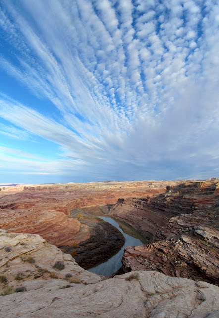
Green River from the Wolverton Overlook
One of two guys flying drones at the Wolverton Overlook
Green River from the Wolverton Overlook just after sunset
The La Sals glowing pink
Bright clouds after sunset
Saturday night's camp above Labyrinth Canyon
-
Post Thanks / Like - 3 Likes
-
03-10-2019, 11:23 PM #3
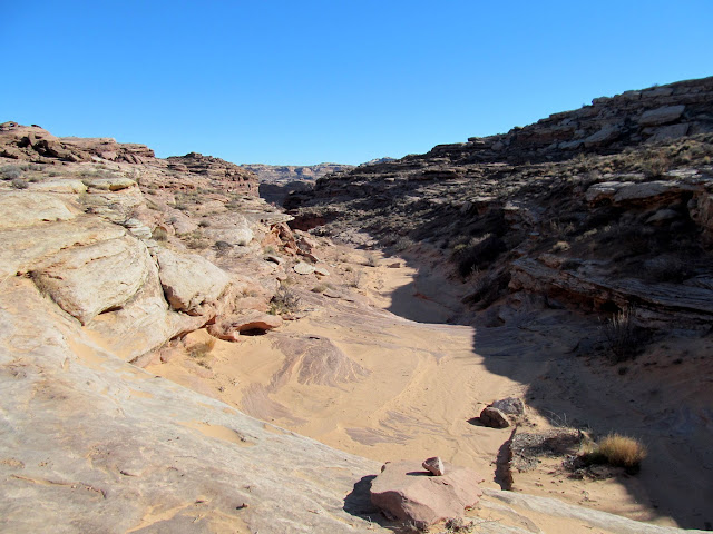
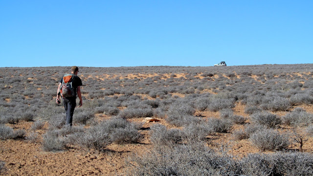
On Sunday morning after packing up camp we set out for one last hike. I parked the Jeep a short distance from camp and we started down an old two-track road for a bit, then cross-country toward Wolverton Canyon. We took a slight detour when I saw some cliffs that caught my interest. There we found a couple of metates but no other signs of habitation. Farther down the canyon we had to bypass two dryfalls before reaching the top of the constructed trail in Wolverton Canyon.
Sunday morning at camp
Old two-track leading toward Wolverton Canyon
Descending toward Wolverton Canyon
Heading down to check out some cliffs in the distance
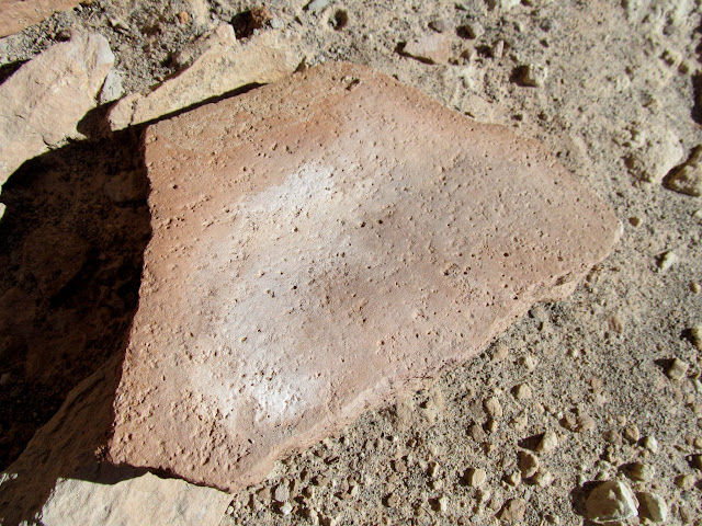
Maybe a metate?
Definitely a metate
Ledges where I found a couple of metates
Wolverton Canyon
Descending back into the canyon after bypassing a dryfall
Another big dryfall coming up
The top of the Wolverton Trail had only a little construction. We reached the bottom of the canyon and couldn't tell where the trail went. Chris set off into a boulder field, while I searched the opposite side of the canyon. I found where the trail ascended the other side and then continued down-canyon just below a cliff band. Along the way I spotted a small inscription by C.H. from one hundred years earlier. We followed the trail down to the Green River. The lower section was heavily constructed and could have served as a wagon road, except that there was no way for a wagon to get through the upper section of trail!
Chris at the top of the constructed trail
Top of the trail
Chris unknowingly took the difficult way through the boulders
I found where the trail goes up the other side of the canyon
Likely route of the original trail
Very tiny inscription: C.H. 1918
Rock wall supporting the trail
We poked around the mouth of the canyon hoping to find some inscriptions or rock art but unfortunately came up empty. With our exploring done, we ascended the trail by the same route we'd come in on, got back in the Jeep, and headed home.
At the Green River
Rock wall near the river
Going back up the trail
Horse or burro skull
Almost back to the Jeep!
-
Post Thanks / Like - 6 Likes
-
03-11-2019, 03:10 AM #4Bogley BigShot


- Join Date
- May 2007
- Location
- We're all here, because we ain't all there.
- Posts
- 19,424
great report-again
 I'm not Spartacus
It'll come back.
Professional Mangler of Grammar
Guns don't kill people--Static Ropes Do!!
Who Is John Galt?
-
03-11-2019, 08:35 AM #5
Dennis -- your trip reports are always a delight. I love creeping through your report, one pic at a time.
That picture of the pink Las Sals is outstanding. Frame-worthy for sure. What did you shoot it with?
I want this on my wall:
Last edited by rockgremlin; 03-11-2019 at 08:40 AM.
It's only "science" if it supports the narrative.
-
Post Thanks / Like - 2 Likes
-
03-11-2019, 09:22 AM #6
Yeah, that's a great picture. I love it when you're in the right place at the right time. I bought a new camera a few months ago that takes really great pictures...an Olympus TG-5.
Suddenly my feet are feet of mud
It all goes slo-mo
I don't know why I am crying
Am I suspended in Gaffa?
-
03-11-2019, 09:25 AM #7Thanks, RG! All these were taken with my Canon point-and-shoot (PowerShot SX150). Here's the full-sized version for you to do with as you please. :)
 Originally Posted by rockgremlin

-
Post Thanks / Like - 1 Likes
 rockgremlin liked this post
-
03-16-2019, 04:41 PM #8
Excellent Post!
Great Report! Thank you! Ill be heading down to Wolverton this week (19-20 March 19)
-
03-18-2019, 08:43 PM #9
That was really enjoyable. Thanks for sharing!


 Reply With Quote


Similar Threads
-
[Invite] Canyons this Spring
By Archie in forum CanyoneeringReplies: 4Last Post: 02-28-2017, 09:22 AM -
[Trip Report] November 12th Big Spring Canyons
By Audilard in forum CanyoneeringReplies: 1Last Post: 11-17-2011, 05:53 PM -
Lake Powell Canyons - Moepitz, Anasazi and Lehi Canyons and/or General Powell
By AJ in forum CanyoneeringReplies: 0Last Post: 05-19-2010, 05:51 PM -
Spring is Here!!!!
By asdf in forum General DiscussionReplies: 12Last Post: 04-16-2009, 08:24 PM -
Spring, Spring where are you?
By Scott P in forum General DiscussionReplies: 37Last Post: 03-03-2007, 07:18 PM
Visitors found this page by searching for:
Outdoor Forum
