

Results 1 to 4 of 4
Thread: Southwestern Swell and Beyond
-
03-13-2018, 10:04 AM #1
Southwestern Swell and Beyond
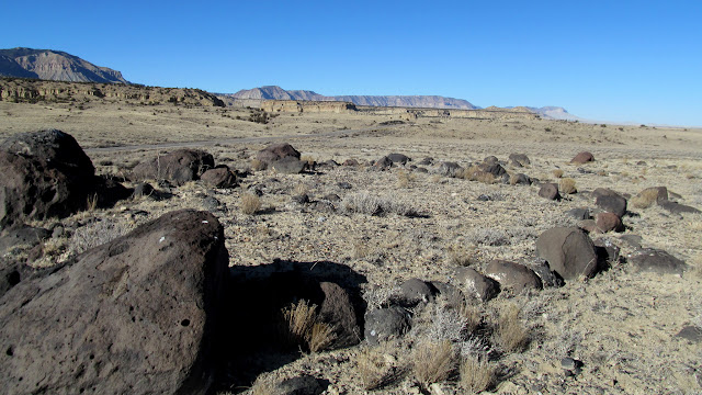
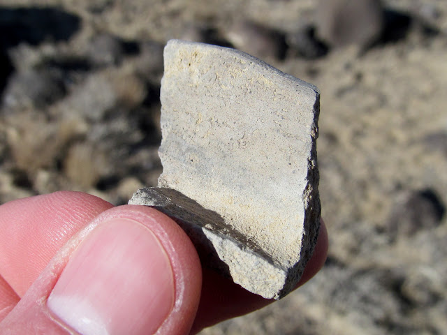
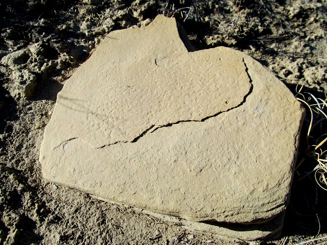
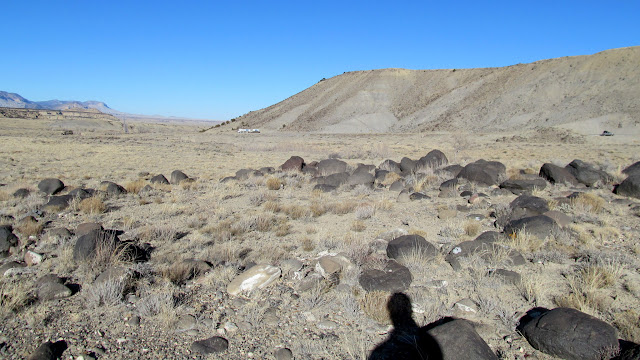
I spent a couple of days during Presidents' Day weekend with my friend Chris in and around the southwestern San Rafael Swell. On Friday afternoon, we knocked out a couple of things on my long to-do list before sundown. During the drive south we stopped along Highway 10 to visit what I thought were pit houses that I'd seen in Google Earth. After seeing them, I wasn't so sure they were pit houses, but they were definitely some sort of native American-built stone circles. Each one was larger in diameter than a normal pit house, and there was no depression in the middle nor enough rocks to have formed walls more than one course high. There were plenty of lithic flakes and potsherds to identify them as Fremont sites, however. I even spotted a pecked grinding stone along the banks of Ivie Creek while hiking to one of the stone circles. We also revisited Snake Rock Village just off I-70 where there are several pit houses and a few petroglyphs.
Stone circle along Oak Spring Creek
Unusual potsherd
Pecked grinding stone along Ivie Creek
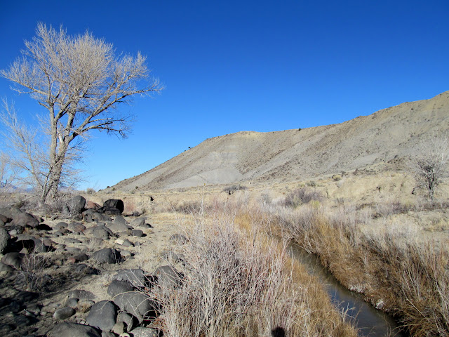
Ivie Creek
Potsherds and lithic flakes
Stone circle near Ivie Creek
Snake Rock
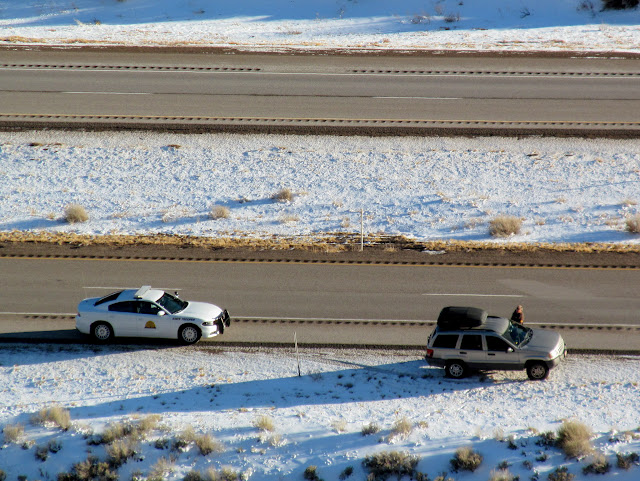
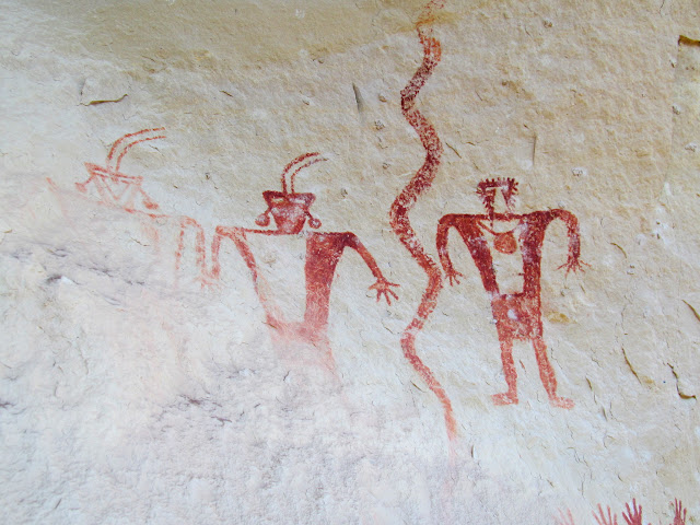
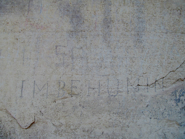
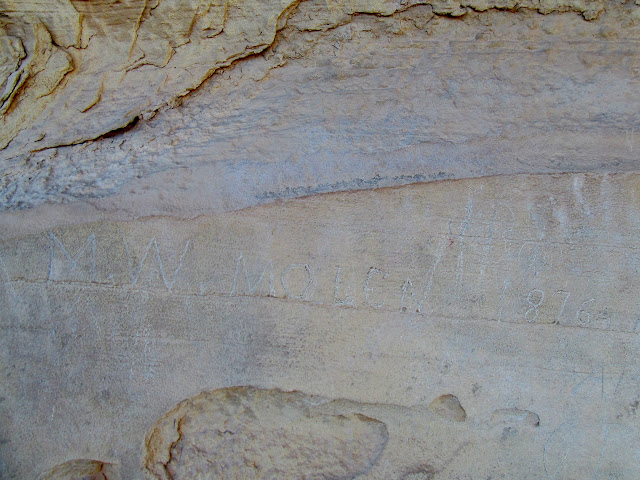
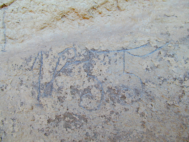
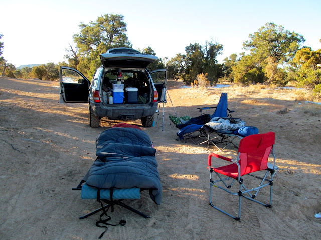
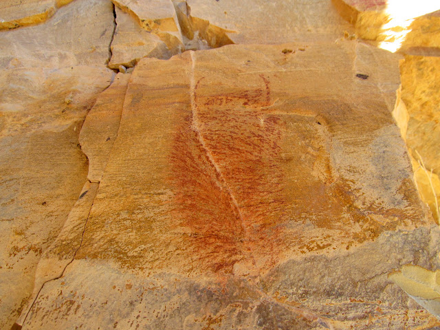
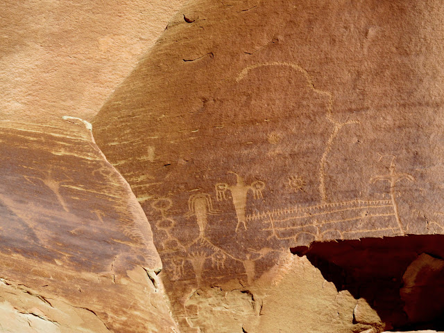
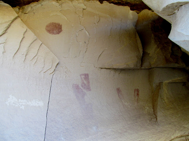
Next we moved farther upstream along Ivie Creek and scrambled up to some pictographs. I'd known about the pictos for years, and had driven past them many times without stopping. It felt great to finally have the opportunity to see the rock art up close rather than in passing as I was driving by. After we'd crossed the creek and were scrambling up a steep hill, a Utah Highway Patrol trooper pulled up behind my Jeep and was obviously trying to puzzle out where we'd gone. He followed our footprints in the snow to where we'd dropped down a steep hill, crossed a barbed wire fence, and crossed the creek. It seemed as though he was looking up toward the cliffs trying to spot us, and I even waved a couple of times, but I don't think he could see me. He eventually drove off and we continued toward the rock art. The pictographs were quite excellent. There were also some old inscriptions nearby, including a few from members of the Elk Mountain Mission. While hiking back down toward the highway, another (or perhaps the same) UHP car pulled up behind the Jeep, but this time the trooper drove off without getting out of his vehicle. The sun was about to set, and Chris and I headed to Justensen Flats and found a nice spot to camp. We had a small campfire and set up cots to sleep on, with no tents. It got quite cold during the night and our water bottles froze solid.
Statie checking out my Jeep
Ivie Creek pictographs
I.M. Behunin
M.W. Molen, 1876
1855
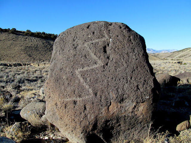
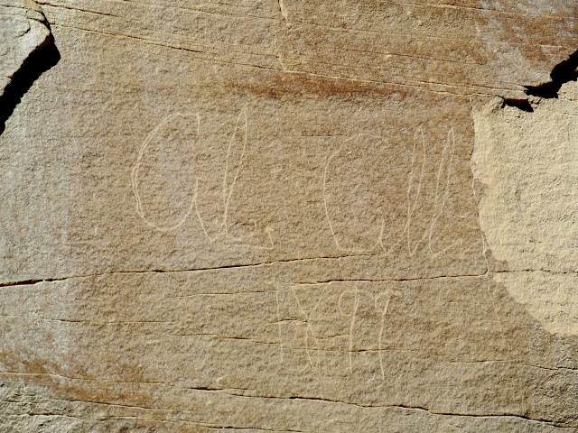
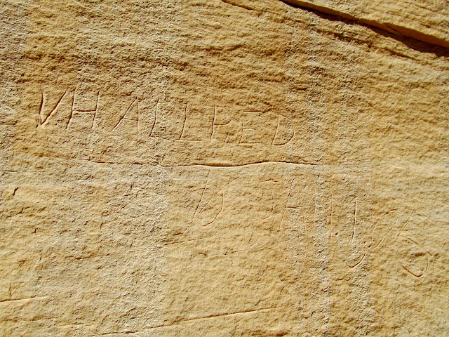
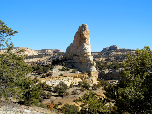
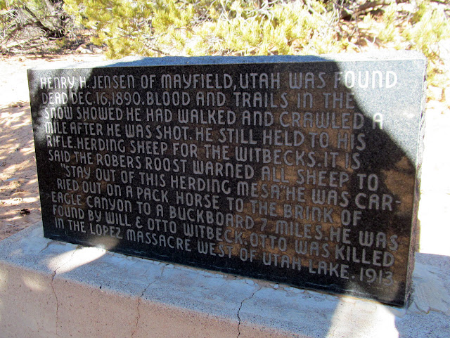
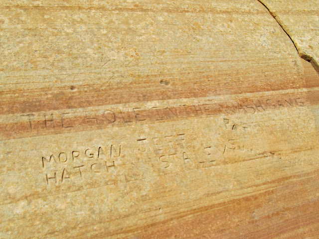
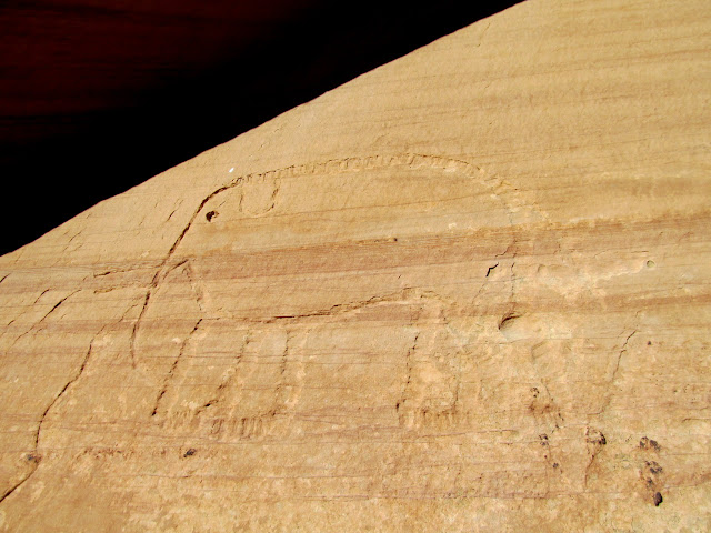
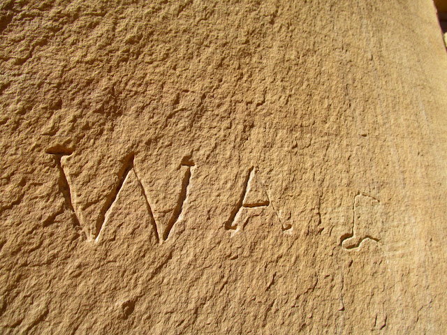
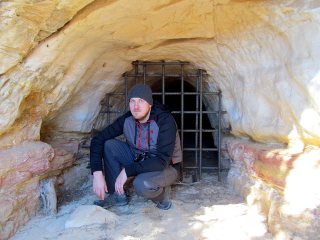
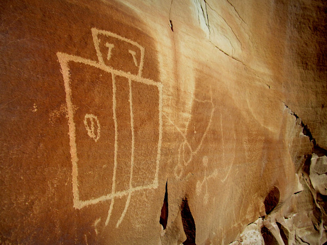
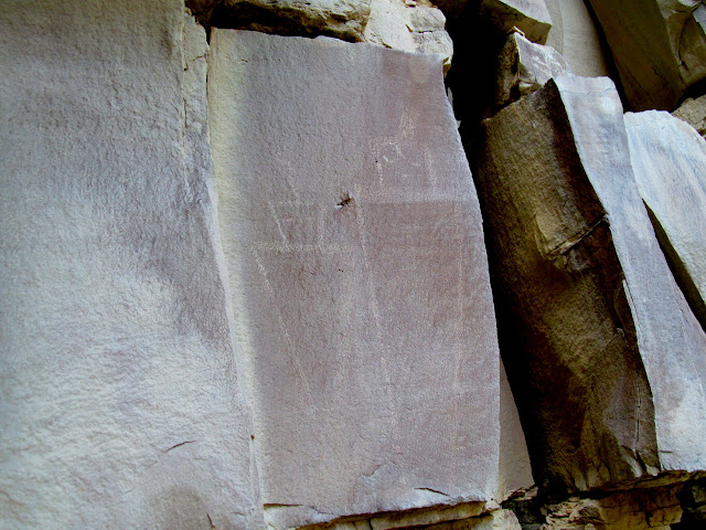
We slept in until after sunrise on Saturday morning. After coffee and breakfast, we set out to drive an all-day loop past the Copper Globe area. On the way to Copper Globe we spotted some inscriptions right along the road, the oldest dating to 1899. I was amused upon seeing an inscription by V.H. Allred, where it appears he started to write "December," but scratched it out and wrote "Jan. 1, [19]05." We also stopped at a memorial to Henry Jensen, who was killed in the area in 1890. At Copper Globe, we checked out the mines, cabins, and inscriptions and other rock carvings that are scattered around. There were even some petroglyphs that I wasn't previously aware of.
Camp at Justensen Flats
Gil. Gillies(?) 1899
V.H. Allred, Jan. 1, 1905
Rock formation near the road to Copper Globe
Henry Jensen memorial
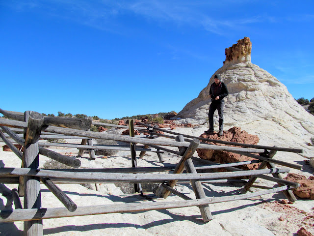
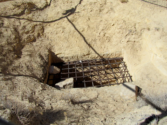
Ridiculous fence around a four-foot-deep mine shaft
The Hole in the Wash Gang: Morgan Hatch, Jeff Staley, Pat Sundstrom
Elephant carving
W.A. inscription
Chris in front of a closed mine tunnel
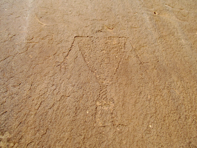
Petroglyph at Copper Globe
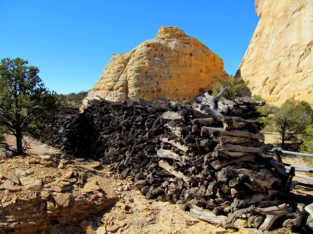
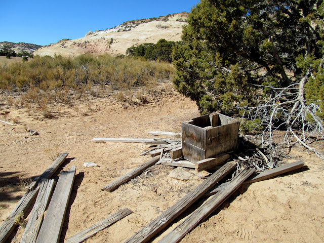
Wood pile at Copper Globe
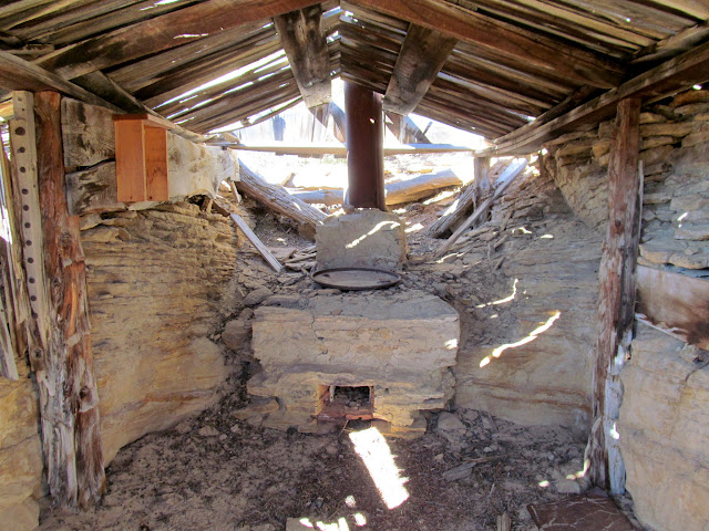
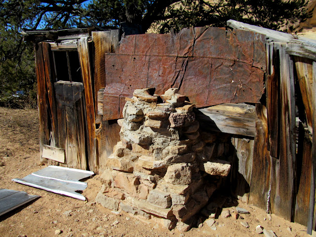
Partial dugout cabin with oven
Copper Globe Mine
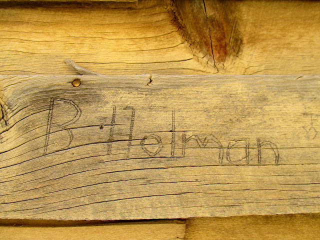
B. Holman
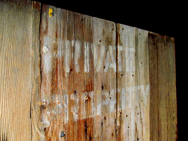
Private Property
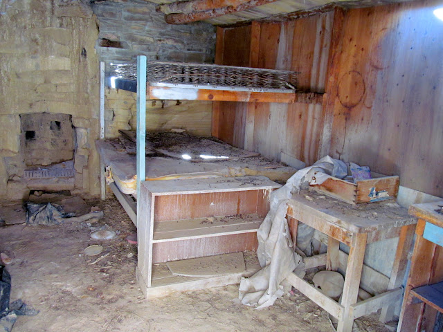
Bunks in a cabin
What's left of the shitter
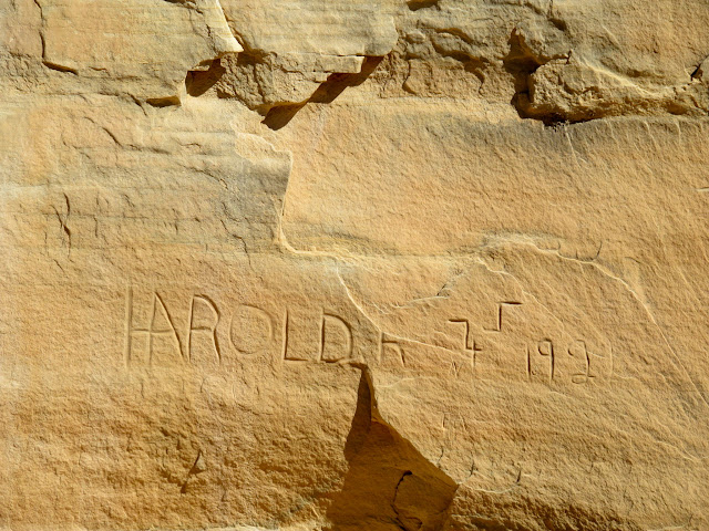
Harold R., 1922
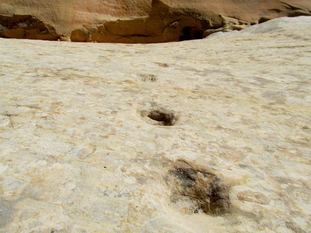
Steps carved into the sandstone below some inscriptions
Fireplace
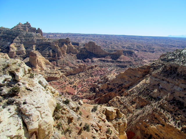
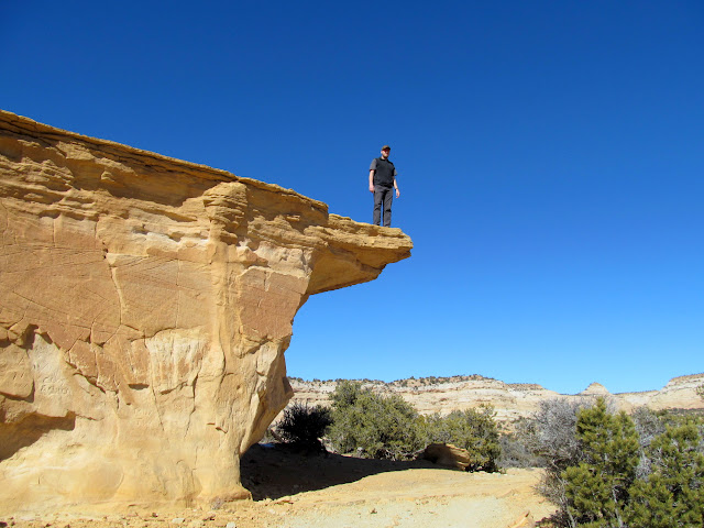
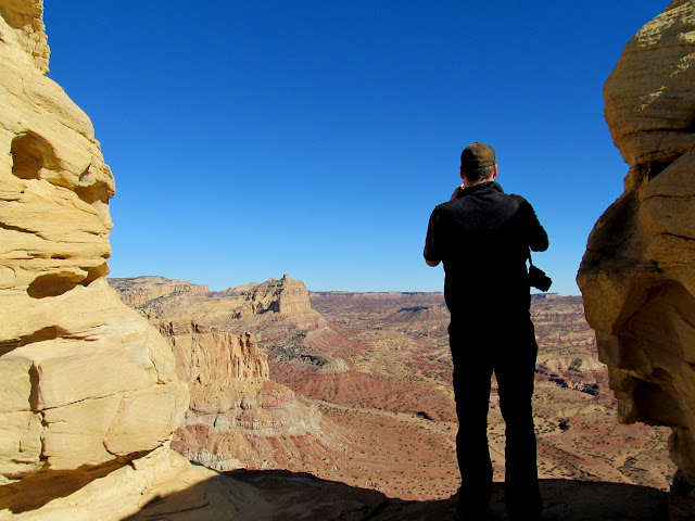
Leaving Copper Globe, we continued south and stopped at a couple of nice overlooks of Sulphur Canyon and Red's Canyon. The Window, so named because of a break in the cliffs that offers a view into Red's Canyon 1,000 feet below, was one of the highlights of my day because I'd been near there twelve years earlier but hadn't stopped to enjoy the view back then.
Sulphur Canyon overlook
Chris on the high dive
Chris at the Window
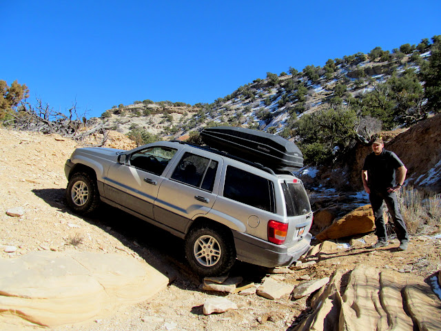
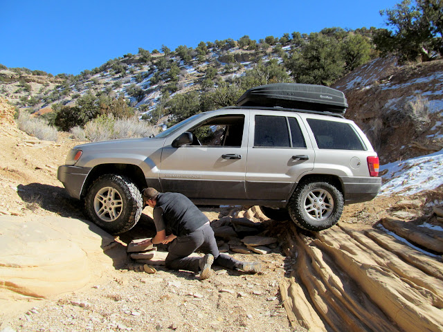
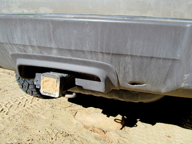
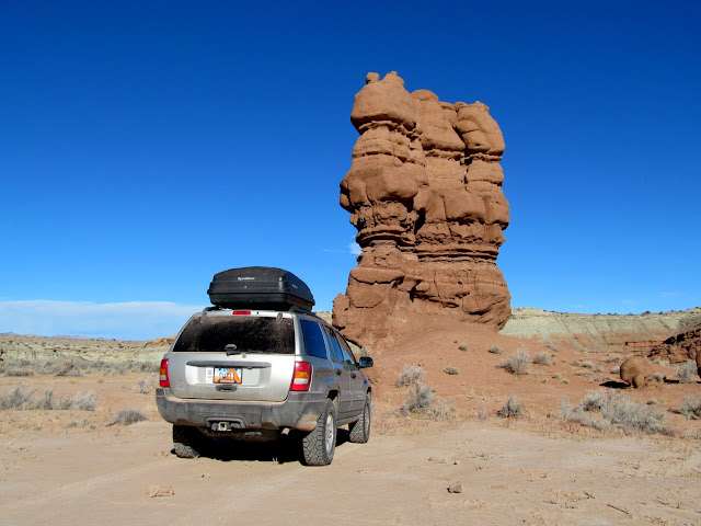
We next tried driving onto Sagebrush Bench to find a couple of geocaches and visit a brush corral. The road was seriously washed out in one spot, but I thought my Jeep could make it up the other side. While driving through the washed-out portion of the road, the hitch on the Jeep scraped on several small sandstone ledges, and the tires lost traction while trying to climb up the other side. I gave it a couple of tries but the tires kept spinning in the loose dirt. I tried backing up but the hitch hit those small ledges and got completely hung up, and the Jeep suffered a small hole in the bumper. The wash was too narrow to turn around in, so Chris and I decided to try stacking rocks to get the rear-end of the Jeep clear of the ledges. Luckily there were a lot of flat rocks nearby to make some ramps about 10 inches tall. We were able to get the Jeep clear of the small ledges and, surprisingly, I was able to back up the snow-covered slope leading into the wash.
Stacking rocks to get unstuck on the Sagebrush Bench road
Almost out!
Damage to my bumper
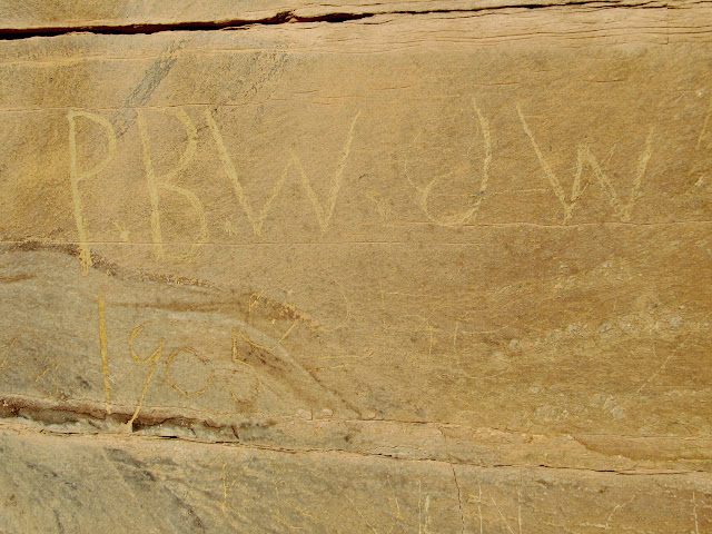
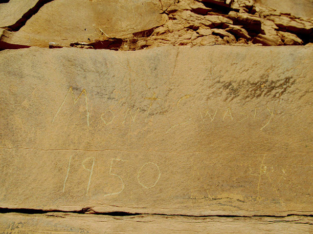
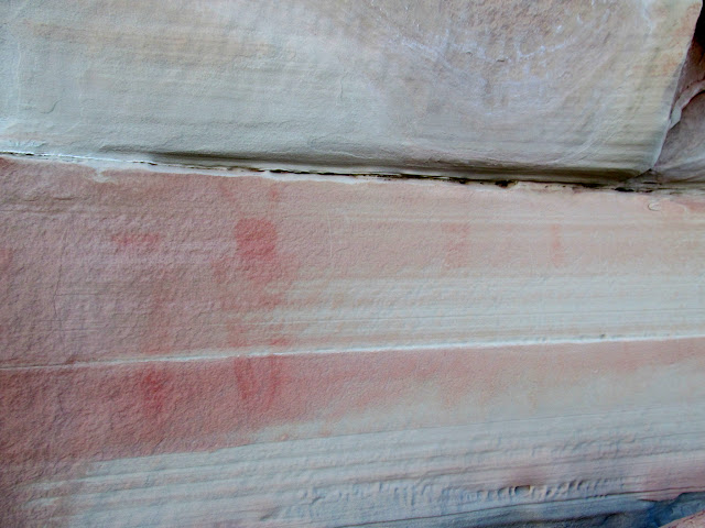
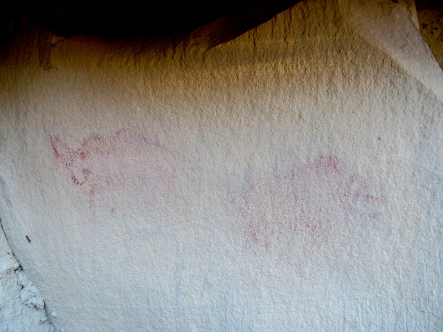
After quickly checking out a steel dam at the head of Cat Canyon, I decided that I didn't want to drive the gnarly road back north past Copper Globe, so we headed west through Cat Canyon and Kimball Draw. We stopped at the pictographs in Kimball Draw and I found an inscription that I hadn't noticed there before dating back to 1905. We reached I-70 with some time to kill before sunset, and I remembered a friend telling me about some pictographs on nearby Sand Bench, so we headed that way. I didn't have the coordinates, so I tried locating them by what I remembered seeing in Google Earth many months earlier. We hiked right past the faded pictographs twice before finally noticing them on the third pass. We didn't have specific camping plans that night, but since we were close enough to Justensen Flats, we just drove back to the same spot we'd camped at the previous night.
Collapsed steel dam at the head of Cat Canyon
Chris on the slickrock
Kimball Draw pictographs
Horned figure
P.B.W., J.W., 1905
Mont Swasey, 1950
Sand Bench pictographs
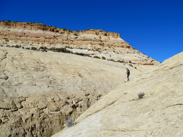
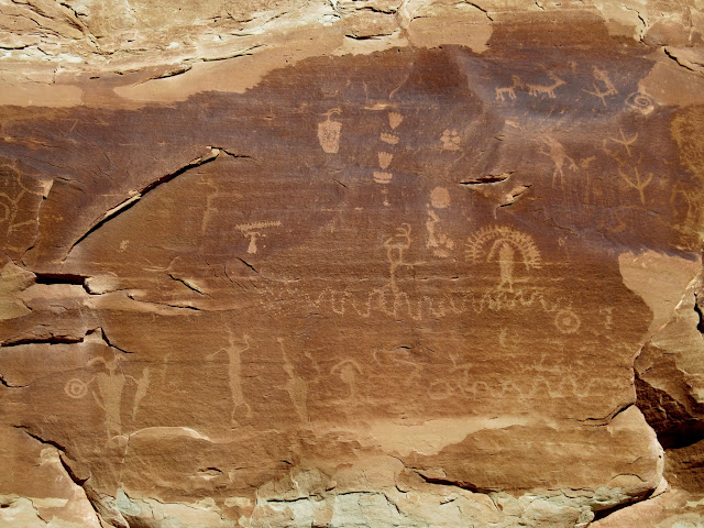
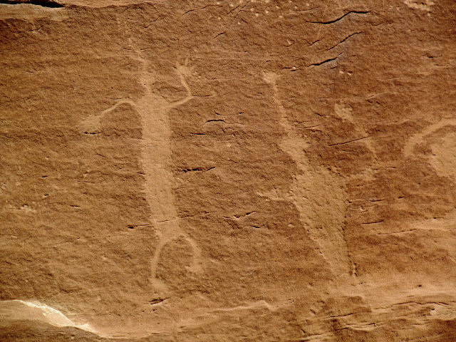
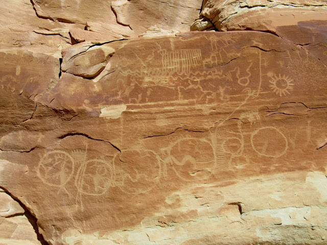
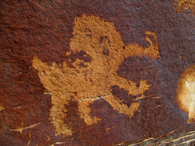
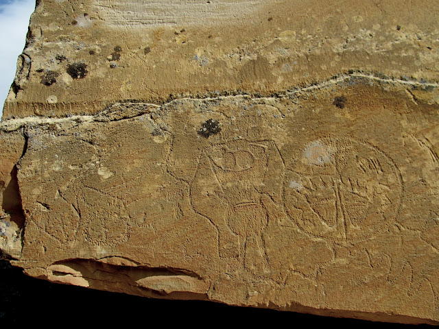
Sunday was completely unscripted. I pulled out my Utah atlas after breakfast and tried to figure out somewhere to go that was nearby. We settled on an area north of the Moore Cutoff Road near the Red Ledges and Sand Bench which I'd visited about ten years earlier. With only my ten-year-old recollection, we managed to find all the rock art I'd seen during my previous visit, including the very cool Broken-Hearted Man petroglyph.
Sid and Charley
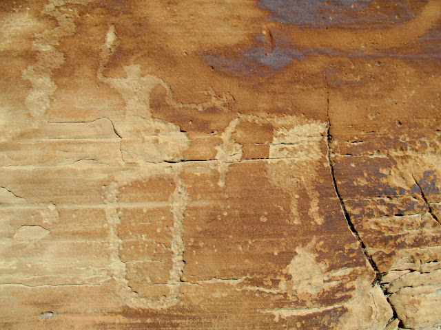
Interesting Fremont petroglyphs
Human-like figures and bear, coyote, and turkey tracks
Pecked and abraded human figures
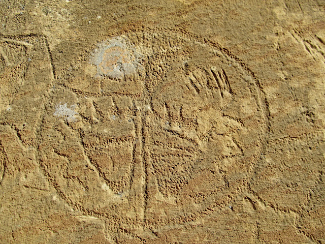
Shield guy with a tail and horns
Many circles
More interesting glyphs
Sheep and archers
Broken-Hearted Man
Possible headhunter petroglyph
Bighorn sheep with a horned snake snout?
Pictographs high in the cliffs
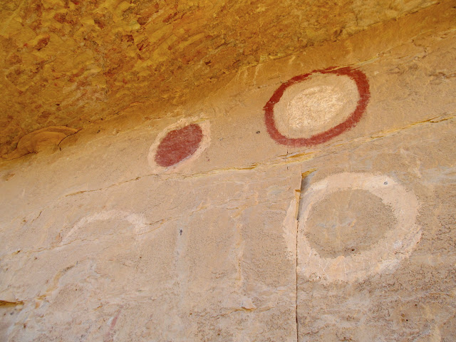
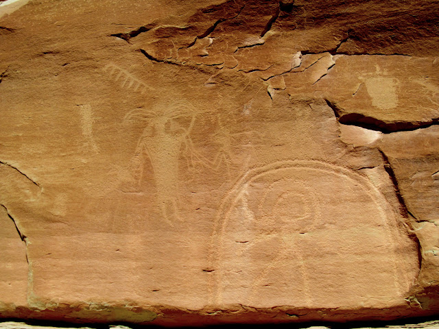
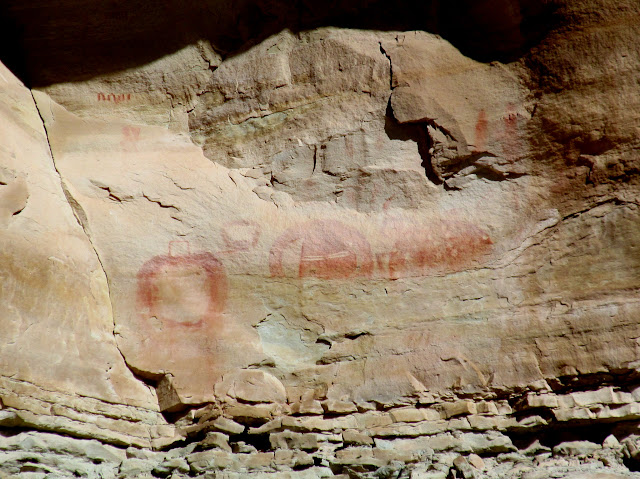
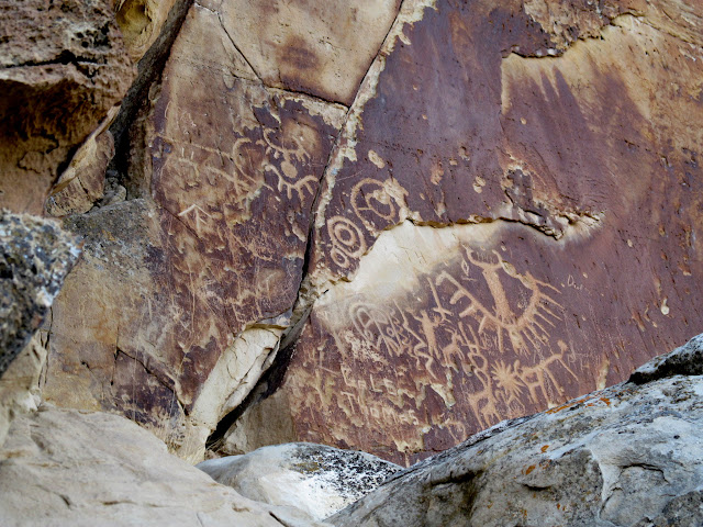
We repeated the atlas process and ended up along Muddy Creek next. There we saw some rock art along the road that I'd seen before, but then set out to locate some petroglyphs that, once again, a friend had told me about but whose location I wasn't certain of. We fumbled around a bit but eventually found the petroglyphs, which conisisted of a large Vernal-style Fremont figure holding a shield with two large bear footprints. The entire panel was larger than I'd imagined, and it was in a fairly unusual spot. Seeing that panel was certainly the highlight of the day.
Pictographs high above Muddy Creek
Large Vernal-style Fremont figure and shield
Shield with bear tracks
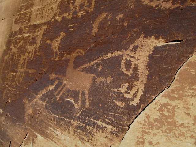
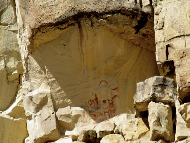
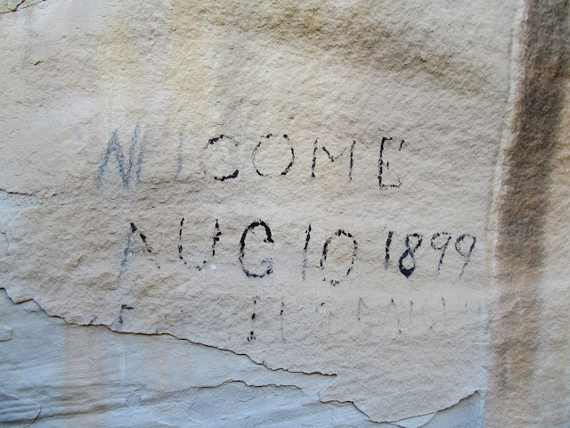
Another quick consult of the atlas and we were on our way toward Ferron Creek. We visited some easily-accessible petroglyphs near the road and viewed others across the creek through binoculars (those will be the focus of a future trip). While parked along the road searching with binoculars for any other rock art, I was pleasantly surprised when my friend Alan pulled up behind the Jeep. He was on his way farther up the canyon, toward the same location Chris and I were planning on seeing next, so we all went there together and hiked to some pictograph panels that were badly faded. That was our last stop of the trip, and Chris and I headed back to Price. It hadn't felt like a particularly busy trip, but I was surprised how many sights we were able to cram into two days.
Ferron Creek petroglyphs
Welcome, Aug. 10, 1899
Pictographs near Ferron Creek
Bison pictographs, possibly fake
Abraded Fremont figures
Full Photo Gallery: Southwestern Swell and Beyond
-
Post Thanks / Like - 5 Likes
-
03-13-2018 10:04 AM # ADS
-
03-13-2018, 10:35 AM #2
Really cool stuff. Thanks for the share.
That Copper Globe stuff is interesting. I've been out there a few times, and always been surprised at the degree of work that went into driving that vertical shaft. It's a lot of work to drive a vertical shaft with today's technology, let alone the primitive single jacking techniques that the old timers used. Since that main shaft goes so deep, I've always felt like they were digging deeper with the hopes of finding more than just copper.It's only "science" if it supports the narrative.
-
Post Thanks / Like - 1 Likes
 Doc Foster liked this post
-
03-20-2018, 06:02 PM #3
Man, I have to get back out into that area again. Thanks for sharing.
-
03-20-2018, 09:21 PM #4
Another great trip report, Dennis! You covered a ton of sites in two days. Those rock rings are indeed intriguing....


 Reply With Quote


Similar Threads
-
[Trip Report] The Swell with The Family
By millsclimber in forum CanyoneeringReplies: 6Last Post: 05-12-2011, 11:38 PM -
Southwestern BLT Taco Salad
By Recipe Feed in forum Food NationReplies: 0Last Post: 05-04-2011, 10:00 PM -
Southwestern Chicken Layered Salad
By Recipe Feed in forum Food NationReplies: 0Last Post: 04-22-2011, 10:20 PM -
Southwestern Corn-Cheese Dip
By Recipe Feed in forum Food NationReplies: 0Last Post: 02-07-2011, 07:40 AM -
[Help] Anyone ever seen this out there in the Swell?
By dioscuriII in forum Hiking, Scrambling & Peak BaggingReplies: 3Last Post: 01-27-2011, 05:28 PM
Visitors found this page by searching for:
Outdoor Forum
